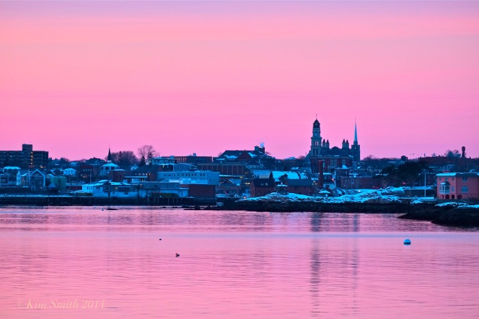
 Gloucester Skyline Winter Sunset
In preparation for my adventure to Mexico to film the Monarchs, nearly every afternoon I have been “hiking” around Eastern Point. According to my car odometer, from the Niles Beach parking lot to the lighthouse and back is just a little over two miles. I realize that I must look fairly comical with headphones, hiking boots, and loaded down with a full backpack, all while trying to dodge the black ice. The walk is always beautiful–the freezing temperatures and icy roads not so much!
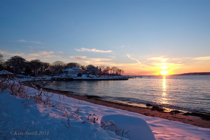 Raymond’s Beach Sunset
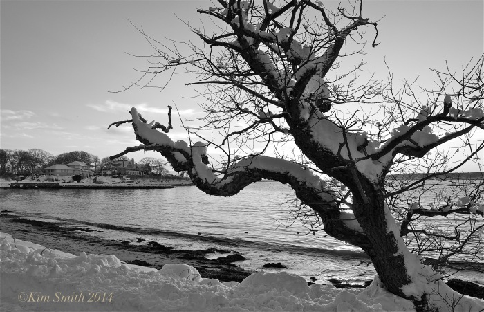 Raymond’s Beach Cherry Tree
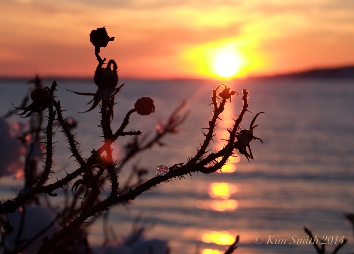 Rosa rugosa
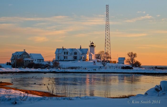 Eastern Point Lighthouse
Spread The GMG Love By Sharing With These Buttons:
Related
Published by Kimsmithdesigns
Documentary filmmaker, photographer, landscape designer, author, and illustrator. "Beauty on the Wing: Life Story of the Monarch Butterfly" currently airing on PBS. Current film projects include Piping Plovers, Gloucester's Feast of St. Joseph, and Saint Peter's Fiesta. Visit my websites for more information about film and design projects at kimsmithdesigns.com, monarchbutterflyfilm.com, and pipingploverproject.org. Author/illustrator "Oh Garden of Fresh Possibilities! Notes from a Gloucester Garden."
View all posts by Kimsmithdesigns
 Gloucester Skyline Winter Sunset
 Raymond’s Beach Sunset
 Raymond’s Beach Cherry Tree
 Rosa rugosa
 Eastern Point Lighthouse

Kim ~ you are an inspiration ~ keep going and Hold Fast ~
LikeLike
Thank you Mary and thank you again for your beautiful and thoughtful gifts. My extra memory card is packed and ready to fill!
LikeLike
Nice.
I’ve got to get out more.
LikeLike
Thanks Marty–means much coming from you. Yes get out, but so slippery!!!
LikeLike
Lovely photos.
And I think that you are underestimating the mileage from Nile Beach to the Lighthouse and back. It is 0.7 mile from Fort Hill Ave and the pillars at the Niles Beach end of Eastern Pt Blvd. It is at least 0.5 mile from Fort Hill Ave to the lighthouse. Pat yourself on the back – you are doing better than you gave yourself credit.
LikeLike
Thank You Anonymous! That is the best news of the day. You must walk there frequently to know it so precisely. I was worried i was underestimating!
LikeLike
great shots, and I love that cherry tree, its always such a pretty outline against the sea
LikeLike
Me too–I think I could make a post of just that cherry tree “through the seasons.”
It’s amazing how it survives on that little strip of land and takes the beating that it does every winter!
LikeLike
Crazy stunning.
LikeLike
Thanks so much Jeff.
LikeLike
That is good prepartion for the upcoming trip to mexico and we get the benefit of your hiking pictures…Think the hiking will tax you some coming from sea level on the hike up to Monarchs, I imagine around 10,000 feet and it takes a little time to adapt?…Great time of year for this trip and you have done your homework well won’t have black ice or snow there…Bottled water is a plus. 🙂
LikeLike
It is 10,000 feet Dave. I am a little worried because we don’t have any time to become acclimated to the altitude difference. Setting out to film the day after we arrive.
LikeLike
Kim…
Don’t worry we moved west from sea lever and it was not that taxing for us just slow it down some…Where I lived was 6000 feet and when hitting the mountains went up some Depending upon exact location I think it’s in the Sierria Mountain chains some of it but a lot will depend upon your exact location and I Believe there may be other means of transport up the hill’s horses or mules etc?
Little Wiki
http://en.wikipedia.org/wiki/Mountain_peaks_of_Mexico
Used to up here all the time…
A tramway car ascending the Sandia Mountains. The Sandia Peak Tramway is an aerial tramway located adjacent to Albuquerque, New Mexico, USA. … from a base elevation of 6,559 feet (1,999 m) to a top elevation of 10,378 feet (3,163 m).
LikeLike
Good light, great composition — very nice work you do, Kim –
LikeLike
Very kind of you to say Bill, thank you–always chasing the light.
LikeLike
Kim do you sell prints of any of your photographs. I am particularly interested in Eastern Point Light House, (my great great granddad was the first lighthouse operator) and Raymond’s Beach where I grew up over summers.
LikeLike
Samuel Wonson ~ born May 12, 1773 died September 16, 1850? Are you a Wonson ~ me too ~
LikeLike
Thank you Laurie for your interest. Yes I do sell prints. Please feel free to email me at kimsmithdesigns@hotmail.com.
LikeLike
Beautiful pictures because we live in a beautiful city.
LikeLike
Yes beautiful, beautiful city Patti!
LikeLike
breathtakingly beautiful–and the colors are otherworldly–typical Gloucester technicolor sky and water!
LikeLike
Yes, a capture–I can’t take credit for the colors!
LikeLike