Bill O’Connor submits-
Hi Joey,
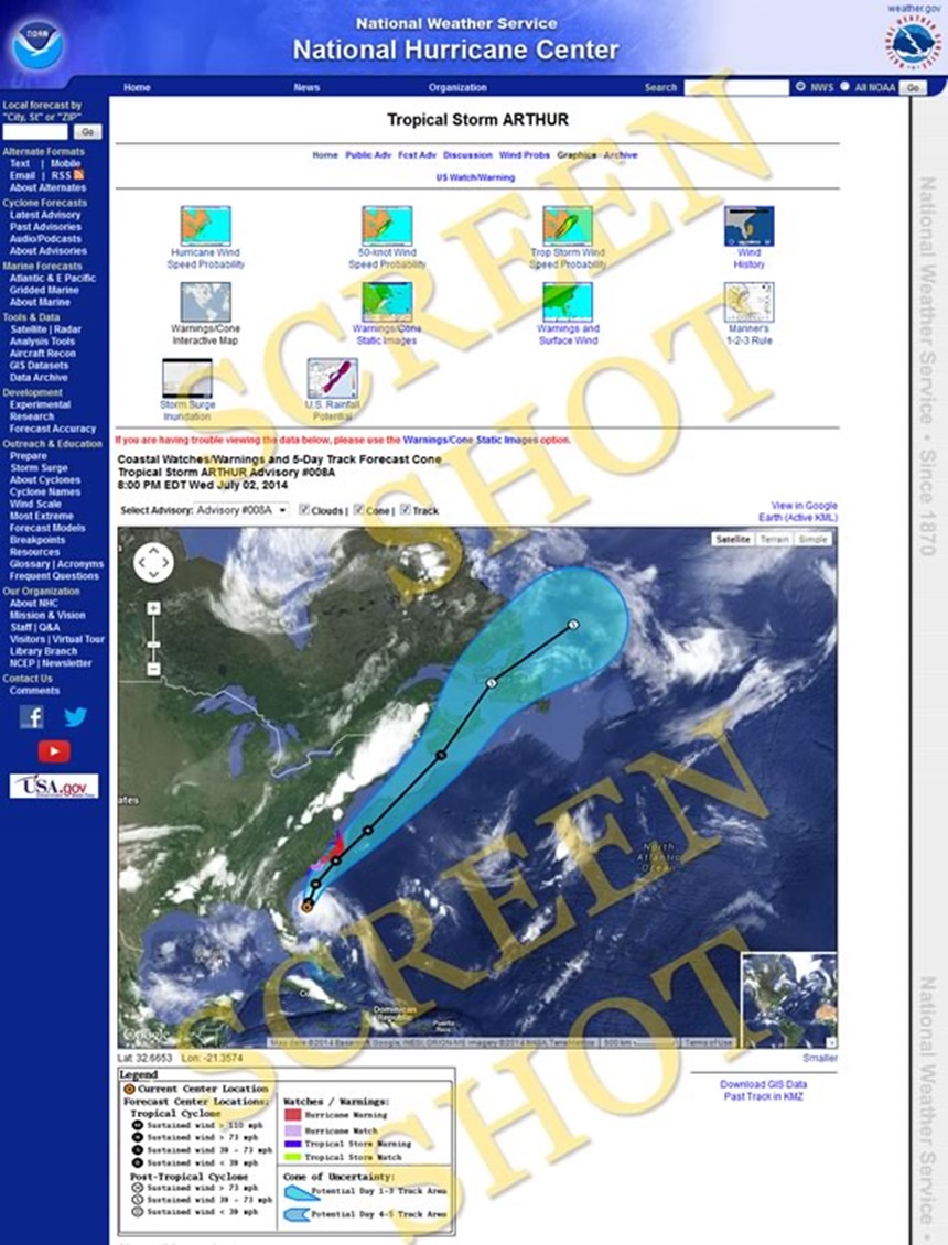
With Tropical Storm/maybe Hurricane Arthur approaching, I thought GMG readers might be interested in some of the raw data available from the National Weather Service. Most weather related information that is available on the internet and in the media is rooted in information from the NWS, because they aggregate collected weather data from all over the world and share it publicly as a gavernment service. NWS runs the National Hurricane Center, a site that serves up raw unadulterated weather data related to Hurricanes and Tropical Storms that’s free from any commentary. This is a great tool if you are into tracking the weather as it happens directly from the source.
When you land on the NHC homepage, you will be presented with a map that has each active tropical storm’s and hurricane’s current position on the map. Choose the storm you want to track and click on it [on the map]. Clicking the storm will bring you to a page that has all kinds of data on the storm, with maps that will show storm surge predictions, surface wind info, wind speed probability, history and all kinds of other data. Keep an eye out for the Warnings/Cone Interactive Map, it’s the familiar map with the projected storm path, but includes coastal warning information as well.
· Here’s a link for the overview page for Arthur: http://www.nhc.noaa.gov/graphics_at1.shtml?5-daynl#contents
· Here’s a link to the large tracking map for Arthur: http://www.nhc.noaa.gov/graphics_at1.shtml?gm_track?large#contents
These pages use aggregated data to generate the maps and reports available, but if you’re really geeky, I would suggest a visit to the Observations – Radial Search page. There you can input the center of your search area [latitude & longitude] and the distance and time period you would like to search in all directions from that point. The search result will spit out a table of weather observations from the given time range. Data sources would include buoy data, C-MAN station data, Drifting Buoys, Ships and other sources (like lighthouses). Weather information included in the raw data is wind speed and direction, peak gusts, wave height, wave frequency and wave energy, barometric pressure (and trend) at sea level, air temperature, sea surface water temp , visibility, tide, water depth of reporting station, and some stations will even report swell activity.
· Radial Search Page for Arthur: http://www.ndbc.noaa.gov/radial_search.php?storm=at1
· Radial Search Page with blank search parameters: http://www.ndbc.noaa.gov/radial_search.php
Enjoy!
~Bill O’Connor
North Shore Kid


This is great. Thanks a lot for the links!!
LikeLike